- Home
- Industries
- Products
- Solutions
Businesses
Governments
Industry
SIAS
- Services
- Contact Us

ABOUT US
Samvriddhi Infotech is the solution integrator for Enterprise Technology Solutions with a focus on Integrated Enterprise GIS solutions for Efficient Business Operations.
Read MoreIntegrated Enterprise GIS Advantage
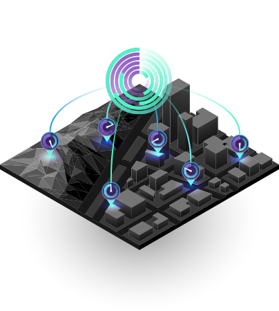
Empower employees to leverage critical location data, advance mapping and real-time spatial analytics to
strengthen operations and decision making from the field to the office.

Planning
GIS enables smarter planning

Operations
Manage and respond to realtime data

Maintenance
Improve the reliability of your assets

HSE
Better emergency response

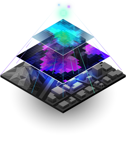
Solve Problems With Big data And Spatial Analytics
We provide your organisations with revolutionary GIS integrated software solutions and data services for Telecom, Transport, Gas and Pipeline,
Real Estate, Land and Surveying, Education and other industries.
Maps
Maps are the geographic container for the data layers and analytics you want to work with. GISmaps are easily shared and embedded in apps and accessible by virtually everyone, everywhere.

Data
GIS integrates many different kinds of data layers using spatial location. Most data has a geographic component. GIS data includes imagery, features and base maps linked to spreadsheets and tables.
Analysis
Spatial analysis lets you evaluate suitability and capability, estimate and predict, interpret and understand and much more, lending new perspectives to your insight and decision-making.

Apps
Apps provide focused user experiences for getting work done and bringing GIS to life for everyone. GIS apps work virtually everywhere: on your mobile phones, tablets, in web browsers and on desktops.
TESTIMONIALS
20k+ clients love our service &
IT related solutions
-
Our vision for implementing GIS was to ensure our employees could access the entire network and asset related information from anywhere, anytime, any device, thus include GIS information in their day to day operational decision making.
The fact that Integrated Enterprise GIS Implementation has allowed a whole lot of information from different systems and databases to come into a single screen makes it easier for the users to access the data and assets information and make informed decisions in real-time. We see GIS as an investment towards enhancing efficiency, automation and enable better decision making not just for operations and maintenance but also safety, emergency management and risk mitigation.E S Ranganathan
Managing Director, Indraprastha Gas Limited
-
GIS has enabled us to measure, compare and analyze data from business operations in conjunction with other data such as potentials risk, transportation networks, regulatory mandates, market characteristics or own customers at every stage – from planning to project implementation to ongoing management of operations.
Ajai Tyagi
Vice President (PNG), Indraprastha Gas Limited
-
GIS technology as a platform has evolved, its no more restricted to department silos and experts. GIS today is intuitive, easy to use and inclusive. The web and mobile access is a huge benefit for the field staff and allows them to measure, compare and analyze asset information and make informed decisions.
S.K.Behera
CGM, ERP & IT, Indraprastha Gas Limited
-
“We see GIS as an investment towards enhancing efficiency, automation and enable better decision making not just for Operations and Maintenance but also Safety, Emergency Management and Risk Mitigation.”
A M Tambekar
Managing Director, Maharashtra Natural Gas Limited
-
“GIS has enabled us to measure, compare and analyze data from business operations in conjunction with other data sources and potentials risks and regulatory requirements at every stage – from planning to project implementation to ongoing O & M Operations.
Santosh Sontakke
Director- Commercial, Maharastra Natural Gas Limited
-
Satisfying to see Samvriddhi Enterprise GIS implementations are aligned to our CGD Integrity Management System regulations to evaluate risks, improve the safety of city gas distribution network and bring more effectiveness in operations to minimize the probability of CGD network failure. Their work with the CGDs is recommendable.
Chairman - Petroleum & Natural Gas Regulatory Board
-
Samvriddhi Enterprise GIS Implementation allow a whole lot of information from different systems and databases to come into a single screen makes it easier for the users to access the data and assets information and make informed decisions in real-time. It also addresses the Integrity Management System regulations to evaluate risks, improve the safety of city gas distribution network and bring more effectiveness in operations to minimize the probability of CGD network failure.
JP Ojha
Executive Director IOCL
-
Samvriddhi innovative approach on Integrated Technology Solutions for Digital Transformation, streamlining large and complex enterprise IT systems into user friendly enterprise applications accessibly by anyone,anytime,anywhere. Samvriddhi uses innovative digital tools to streamline large and complex enterprise systems into user friendly enterprise applications accessibly by anyone,anytime,anywhere.
V P Mahawar
Executive Director Onshore, ONGC
-
Samvriddhi has multiple CGD project implementation experience and they are the domain expert and therefore our Enterprise GIS Implementation has been seamless and aligned with the our CGD Integrity Management System regulations to evaluate risks, improve the safety of city gas distribution network and bring more effectiveness in operations to minimize the probability of CGD network failure.
S. C. Bairagi
MD, Begal Gas Company Limited
Trending Articles & Blogs


Our clients


Industry Association


Subscribe Our Newsletter

Samvriddhi Infotech is the solution integrator for Enterprise Technology Solutions with a focus on Integrated Enterprise GIS solutions for Efficient Business Operations.
Quick Links
Our Services